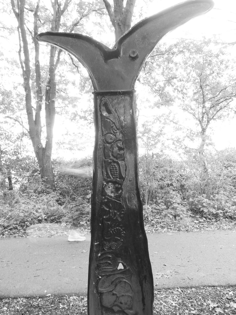
We turned off the A1057, the old Hatfield Road from St. Albans, into a country lane and found Wilkin’s Green just a hundred yards off the main drag. There’s a farmhouse, then a tiny triangle of lanes enclosing a former smithy. From there we headed down a byway towards Bullen’s Green, crossing the Smallford Trail, another of the one-time railway tracks converted into a cycle path. The sculpture above marks the place a little girl was hit by a train in 1929. Look to the left of the sculpture and you can make out a ghost running by, though from the footwear not a child of the 1920s.
A hairy dash across the A414 and then past more former heathland and by a deserted campsite called Cherry Green Trees though no green is marked on the current Ordnance Survey map nor on the 1805-1834 map. So, the name may be unrelated to local history. But this was just the first of the morning’s now-you-see-it, now-you-don’t greens.
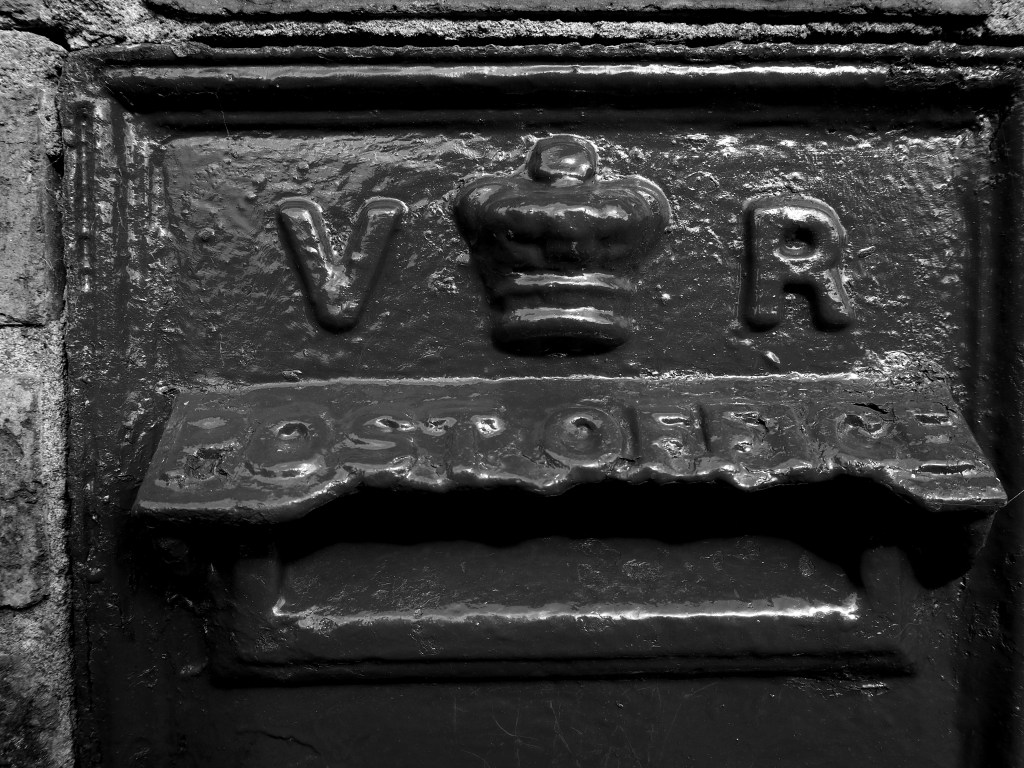
Bullen’s Green boasts a Victorian postbox and there are a few 19th century cottages among a run of newish builds and some between-the-wars houses that could have been transplanted from the suburban sprawls of outer London. With the A1M thundering just a few hundred yards away, it’s a strange place. Smallholdings cower beneath the road. A little away from the traffic, there are livery stables and the occasional ancient oak. We disturbed a heron hunting in dew ponds in a long meadow while a buzzard circled.
Oddly, the old map doesn’t mark a Bullen’s Green but it does have a Dulsham Green that has vanished from the modern map. The old map also has a Row Green and a Chantry Green near our starting place but they have been swallowed up by Hatfield sprawl.
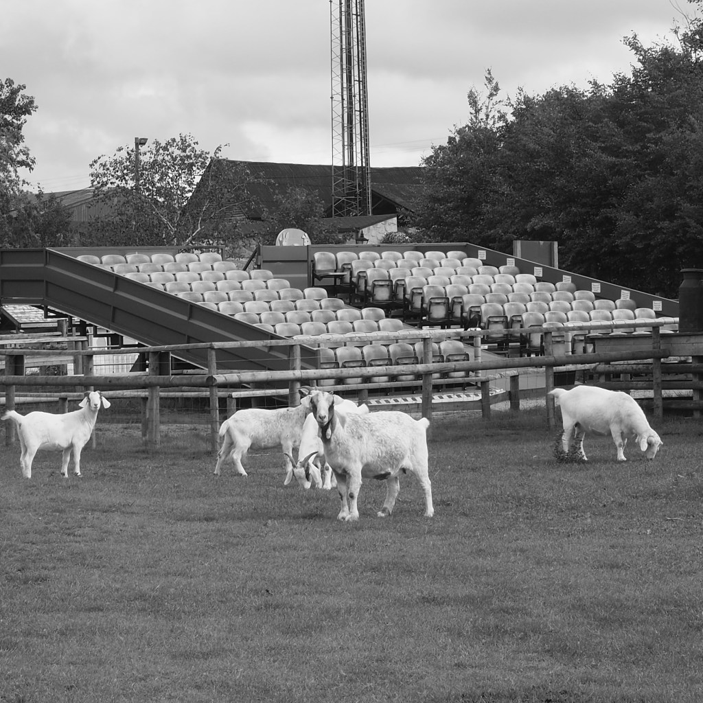
So to Bowmansgreen, just outside London Colney. Or it was. The green is marked on the old map. The new one just shows a Bowmansgreen Farm next to the River Colne. Perhaps we missed it, though I can’t see how. I suspect it has been absorbed into Willows Activity Farm. The footpaths have been reconfigured so you walk round the perimeter of the farm. Lots of interesting smells and sights for Jess the Jack Russell and an unwanted reminder of what Coronavirus has done to our sporting life – the teams may be playing but it’s not the same without the fans.
On the drive back, roadworks and diversions prevented me from following a signpost to Tyttenhanger Green Clinic. There’s no such green on the modern Ordnance Survey but when I looked later there is one on the early 19th century map, with a Primrose Green nearby and a couple of miles north a Coopers Green, neither warranting a mark these days although Coopers Green Lane is still labelled. None of these (or others that have disappeared from contemporary maps) were substantial settlements but nor have they disappeared – the houses still show on the Ordnance Survey. They have had their identity taken away and with it a slice of our county’s heritage. Ghost greens.
